Back Wolkberg Afrikaans وولكبرج ARZ Wolkberg (bukid sa Habagatang Aprika, Limpopo, Mopani District Municipality) CEB Уолкберг Russian 沃克山 Chinese
| Wolkberg | |
|---|---|
 NASA picture of the Wolkberg | |
| Highest point | |
| Peak | Ysterkroon |
| Elevation | 2,126 m (6,975 ft) |
| Listing | List of mountain ranges of South Africa |
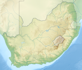
| Coordinates | 24°3′54″S 30°3′54″E / 24.06500°S 30.06500°E |
| Dimensions | |
| Length | 30 km (19 mi) NW/SE |
| Width | 10 km (6.2 mi) NE/SW |
| Geography | |
| Country | South Africa |
| Province | Limpopo |
| Parent range | Drakensberg |
| Geology | |
| Orogeny | Kaapvaal craton |
| Rock age | Neoarchean to early Paleoproterozoic |
| Rock type(s) | Bushveld igneous complex, sandstone |
The Wolkberg is a mountain range in Tzaneen, Limpopo Province, South Africa. It is a northern termination and a subrange of the Drakensberg mountain range which lines up from Eastern Cape, Lesotho, Kwazulu Natal and Mpumalanga. At 2200 m (7200 ft) above sea level, it is the highest mountain range in Limpopo, together with the Iron crown mountain. Its Meteorological significance is that it brings along cold fronts and is a source of cold winters throughout the Limpopo province, the cold front gets transferred from greater Drakensberg mountains in Kwazulu Natal all the way to the Wolkberg. Without the Wolkberg, Limpopo will not experience cold winters at all . The range extends for about 30 km (19 mi) in a NW/SE direction north of Sekhukhuneland. The nearest towns are Haenertsburg and Tzaneen.
